
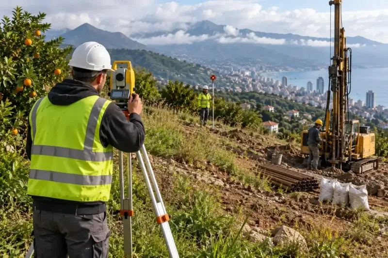
Site surveys in Batumi: boundaries, topography, geotechnics, setting out
We carry out site surveys in Batumi before the house is designed: we stake out the boundaries from registry coordinates, survey the terrain and services, drill boreholes under the footprint of the future house, and during construction we set out the axes and do as-built surveys. The order and scope depend on the plot: the coast, a clay slope or the mountains. Reports go to the architect and structural engineer. A topographic survey of a plot up to 1 000 m² from 1 020 ₾.
from 1 020 ₾topographic survey of a plot up to 1 000 m² at 1:500 scale. The final price is confirmed once agreed.
- Timeline: surveys for a private house usually take 2–4 weeks, with the geotechnical part longest because of the laboratory
- Warranty: We stand behind the accuracy of our boundary and topographic surveys
Who it’s for
You have bought a plot and are about to design a house
You are looking at a plot and want to check it before the deposit
A sloping plot where you need to know what foundation it will take
The fence is not where the boundary is in the documents
You are planning to add a storey to or reconstruct an old house
What’s included
- checking the Public Registry extract
- boundary staking
- a topographic survey with terrain and services
- a geotechnical investigation
- a survey of an existing house
- setting out and checks during construction
- as-built surveys
- reports for the architect and structural engineer
Site surveys in Batumi: why they come before the design
Site surveys in Batumi are everything you need to know about a plot before the architect starts drawing the house. Where the boundaries really run, what the terrain is like, where other people's pipes and cables go, what ground lies under the future foundation and how deep the water is. Without this data the design is built on guesswork, and mistakes surface at the most expensive moment: in the excavation, when the ground turns out weaker, or at the fence, when the neighbour shows their registry extract. Surveys cost a small fraction of the price of the house, while a mistake in the foundation or the boundary takes years to fix.
What site surveys include
| Type of work | What it gives | When it is needed |
|---|---|---|
| Boundary staking | The plot corners on the ground, from registry coordinates | Before buying or before the design, before the fence |
| Topographic survey | A plan with terrain, trees, buildings and services | The basis for the design and landscaping |
| Geotechnical survey | Soil layers, bearing capacity, water level | The basis for the foundation design |
| Surveying during construction | Setting out, level checks, as-built surveys | During construction |
For a small house on a level plot, boundary staking, a topographic survey and a few boreholes or trial pits are enough. For a slope, a basement, a pool or a three-storey house the geotechnical survey needs to be more detailed, and its scope is set by the structural engineer. How survey results turn into a foundation is described on the foundations page.
Order of works
- a Public Registry extract and a check of the land use designation;
- boundary staking and comparison with the fence and neighbours;
- a topographic survey of the plot with terrain and services;
- a geotechnical survey under the footprint of the future house;
- handing the reports to the architect and structural engineer.
The order matters. Boreholes are drilled where the house will stand, and that is only known after the topographic survey and a first sketch. If the plot is still being bought, we stake the boundaries and inspect it before the deposit: that shows whether the fence matches the documents and whether someone else's building or a road encroaches on the plot.
Ground conditions in Adjara
On the coast around Batumi the ground is sand, gravel and river deposits, and groundwater is often close to the surface. On the hills around the city, in Makhinjauri, Mtsvane Kontskhi and Chakvi, clays predominate; they lose strength after prolonged rain, and there are landslip-prone areas on the slopes. Higher in the mountains the ground is rocky in places, but there are also scree slopes. So no two plots get the same survey. On slopes it is especially important to know how the ground behaves; more on the houses on a slope page.
Surveys and the building permit
A building permit usually requires a topographic base of the plot, and for higher-class buildings a geotechnical report too. Which documents your particular house needs depends on the building class and zone, and we check this before ordering surveys so the work is not done twice. We make the topographic survey in the coordinate system used by the Public Registry, so the cadastral boundaries fit onto it without conversion.
Season and weather
Drilling, trial pits and surveying can be done all year, but the weather affects the results. After prolonged rain the water level in boreholes is higher than usual, and we take this into account: the report records when and after what weather readings were taken, and for low-lying plots we recommend repeating the water reading in another season. Overgrown plots are easier to survey in winter when there are fewer leaves, and on clay slopes after a downpour a drilling rig may simply not get in.
If the house already exists
Reconstruction, adding a storey or buying an old house calls for different surveys: inspecting the foundation with trial pits, checking the structure and fitting tell-tales on cracks. The engineer gives a report on whether the house will take the new load and seismic action, and what needs strengthening. More on such work on the foundation strengthening page.
The reports you receive
You receive documents, not a verbal "the ground is fine": a boundary staking plan with coordinates, a topographic plan in electronic form, and a geotechnical report with sections, descriptions of the layers and foundation recommendations. The architect, the structural engineer and the permit application need these documents. They are also worth keeping in the house file: they will be needed again for a sale or reconstruction.
How much site surveys cost
A topographic survey of a plot up to 1 000 m² costs from 1 020 ₾, a geotechnical survey from 3 000 ₾. Boundary staking up to 6 points from 510 ₾, a plot measurement drawing for the Public Registry from 600 ₾. Setting out the house axes from 600 ₾, locating and surveying underground services from 660 ₾, an as-built survey from 510 ₾. A survey of an existing house with a seismic resistance report from 2 820 ₾. The final cost is set after a site visit and an agreed estimate.
Stages and timelines
-
Documents
1–3 days
Extract, land use, coordinates.
-
Boundaries
1–2 days
Staking points, comparison with the fence.
-
Topographic survey
2–5 days
Terrain, trees, buildings, services.
-
Geotechnics
1–3 weeks
Boreholes or pits, laboratory, report.
-
Handover
1–2 days
Reports to the architect and engineer.
Local specifics in Batumi
Plots in and around Batumi vary a great deal. In low areas by the sea and along rivers groundwater is close, and a basement or pool without data on it is a gamble. On the hills, clays hold their shape in dry weather but creep after prolonged rain, and on slopes it matters whether there are signs of landslip. In mountain villages there are rock outcrops and scree, and access for a drilling rig can be difficult.
Adjara is in a seismic zone, and for the calculation the structural engineer needs not only the soil layers but their properties. Some plots were registered long ago, and their boundaries in the registry are inaccurate or overlap with neighbouring plots. So we stake the boundaries and check them against the extract before the design, not when it is time to put up the fence.
Materials and brands
Surveying equipment: GNSS receivers, total stations, levels. Drilling rigs for geotechnical boreholes, probing equipment, tools for trial pits. Samplers and containers for soil and water samples, laboratory testing. Boundary markers. Software for topographic plans and reports, electronic drawings for the architect.
What makes up the cost
Timeline: surveys for a private house usually take 2–4 weeks, with the geotechnical part longest because of the laboratory
- area, terrain and scope of geotechnics
What raises the cost
- a slope, dense vegetation, difficult access
- a basement, pool or tall house
- disputed boundaries and inaccurate registry data
- a large plot area
What lowers the cost
- a level plot with machinery access
- a small house without a basement
We prepare the exact estimate from measurements and photos. It’s free and comes with no obligation.
Get an estimateGuarantees
We stand behind the accuracy of our boundary and topographic surveys. If an error in our data is found during construction, we resurvey and recalculate at our own expense. All reports, plans and coordinates are handed over electronically and in the building file.
Questions and answers
How much do site surveys in Batumi cost?
A topographic survey of a plot up to 1 000 m² costs from 1 020 ₾, a geotechnical survey from 3 000 ₾, boundary staking from 510 ₾. Setting out the house axes from 600 ₾. The final cost is set after a site visit and an agreed estimate, and depends on the area, terrain and the scope of geotechnics.
Which surveys does a private house need?
As a minimum: boundary staking, a topographic survey and a geotechnical survey under the house footprint. For a slope, basement, pool or a house above two storeys the geotechnical survey is more detailed, and its scope is set by the structural engineer. Which documents your building class needs for a permit, we check before work starts.
Can a geotechnical survey be skipped?
For a light structure on a level plot, trial pits and experience from neighbouring plots are sometimes enough. For a house we do not recommend it: without data on the ground and water, the engineer designs the foundation with a large margin, which costs more than the survey itself. And if the margin is not enough, it has to be fixed under a finished house.
What if the fence does not match the boundary?
First stake out the boundaries from the registry coordinates and see who is on whose land. If the difference is small, it is often enough to agree with the neighbour and move the fence. If the registry boundaries are inaccurate or overlap, a measurement drawing and a correction of the data are needed, and this is best done before the design and construction.
Are surveys needed when buying a plot?
Highly advisable, at least boundary staking and an inspection. That shows whether the plot matches the documents, whether there are other people's services, a road or buildings on it, and how steep it is. A geotechnical survey before purchase is less common, but for a slope or a low-lying plot by the sea it can change the decision.
Related services
Terms used on this page
- Public Registry extract
- A document from Georgia's state registry: the owner, cadastral code, area, legal use and encumbrances of a property on the date of issue.
Further reading
Send the cadastral code or extract and photos of the plot: we will price the surveys within 24 hours
We reply within an hour during business hours. Message us or leave a request: we’ll call you back, go over the details and suggest the next step.
Mon–Fri 10:00–19:00, Sat 11:00–16:00