
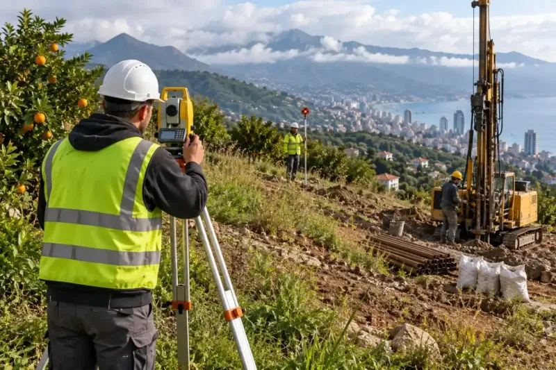
Geotechnical survey of a plot in Batumi: boreholes, pits, laboratory, report
A geotechnical survey of a plot in Batumi shows which layers lie under the house, where the firm ground is, how much it will take and where the water stands. We drill boreholes under the footprint of the future house, dig trial pits and probe where needed, and send samples to the laboratory. The scope is agreed with the structural engineer, and the report with sections and recommendations goes to him. A survey for a private house from 3 000 ₾.
from 3 000 ₾geotechnical survey of a plot for a private house. The final price is confirmed once agreed.
- Timeline: a geotechnical survey for a private house usually takes 2–3 weeks including the laboratory and report
- Warranty: We stand behind the report matching what the boreholes showed
Who it’s for
The plot is bought and the engineer needs data for the foundation
A house on a slope where you need to know how the ground behaves
You are planning a basement or a pool by the sea
Neighbours talk about water in basements and you want to know for sure
You are going to add a storey to an old house
What’s included
- agreeing the scope with the structural engineer
- setting out borehole points under the house footprint
- drilling boreholes with sampling
- trial pits and probing where needed
- measuring the groundwater level
- laboratory tests of soil and water
- a report with sections and recommendations
- an engineer's consultation on the results
Geotechnical survey of a plot in Batumi: what it shows
A geotechnical survey of a plot in Batumi answers the questions the foundation depends on. Which layers lie under the house and at what depth firm ground begins. How much load it will take. Where the groundwater is and how aggressive it is to concrete. Whether there are signs of landslip on a slope, or peat and weak deposits in a low area. The structural engineer designs the foundation from this data, and the more accurate it is, the less extra concrete and steel goes in "just in case".
How we carry out the survey
| Method | What it gives | When we use it |
|---|---|---|
| Boreholes | A section of the layers in depth, soil and water samples | The main method for a house |
| Trial pits | The ground can be seen in the pit wall | Shallow foundations, surveys of old houses |
| Probing | Soil density with depth without sampling | In addition to boreholes, for piles |
| Laboratory | Soil properties and water chemistry | On samples from boreholes |
We drill boreholes under the footprint of the future house, so the geotechnical survey comes after the topographic survey and the first sketch. If the house is moved on the plot after the survey, additional drilling is sometimes needed.
How many boreholes and how deep
For a private house two or three boreholes at the corners of the footprint are usually enough, and their depth is chosen to pass through the zone the foundation loads and into a firm layer. On a slope, with a basement, pool or piled foundation there are more boreholes and they go deeper. The exact scope is set by the structural engineer for the specific house, and we agree it before the drilling rig goes out. Piles need especially detailed data; more on the piled foundation page.
What you get in the report
- a plot plan with the borehole and pit locations;
- geological sections with layers and depths;
- soil properties for the calculation;
- the groundwater level and its aggressiveness to concrete;
- recommendations on the type of foundation and water protection.
Water in the borehole
The groundwater level changes with the seasons. After prolonged winter rain it is higher, at the end of a dry summer lower, and right by the shore it is also linked to the sea level. So the report gives the date of the reading and the weather before it, and for a basement or pool we recommend leaving the borehole and measuring the water again in another season. The waterproofing design uses not the measured level but the highest possible one.
How the survey changes the foundation
On firm clay or gravel a private house often needs no more than a strip or raft. If there are weak deposits on top and the firm layer is deep, piles are better value than a huge raft. High groundwater means waterproofing, drainage and either no basement or serious protection for it. More on the raft option on the raft foundation page, and on drainage on the drainage page. In a seismic zone the ground also affects the design of the whole house; more on the seismic-resistant construction page.
How much a geotechnical survey costs
A geotechnical survey of a plot for a private house costs from 3 000 ₾. Separately you can order a trial pit with a soil description from 420 ₾, borehole drilling from 120 ₾ per metre, probing from 510 ₾ per point, laboratory tests from 330 ₾ per sample. A survey of an existing house with a seismic resistance report from 2 820 ₾, a topographic survey of a plot up to 1 000 m² from 1 020 ₾. The final cost is set after agreeing the scope with the structural engineer and an estimate.
Stages and timelines
-
Scope
1–3 days
Points and depths with the engineer.
-
Fieldwork
1–3 days
Boreholes, pits, probing.
-
Laboratory
1–2 weeks
Soil and water tests.
-
Report
3–7 days
Sections, properties, recommendations.
-
Review
1 day
Discussion with the engineer and you.
Local specifics in Batumi
On the coast from Gonio to Kobuleti the ground under houses is most often sand, gravel and river deposits, and groundwater is close to the surface, especially in winter. Here the survey is needed to see whether a basement is possible and how deep the foundation must go. Sea water right by the shore makes groundwater more aggressive to concrete, and this shows in the laboratory analysis.
On the hills around Batumi there are clays that soak up water and lose strength after prolonged rain, and on slopes there are old landslips that cannot be seen by eye. The geologists look at both the layers and signs of ground movement. In mountain villages there are rock outcrops and scree, and it is harder to get a drilling rig there, so we more often work with trial pits and light drilling.
Materials and brands
Drilling rigs for geotechnical boreholes, hand and machine tools for trial pits. Static and dynamic probing equipment. Samplers, sealed containers for soil and water samples. Laboratory tests: moisture content, density, grading, strength, chemical analysis of water. Software for sections and reports, plans with borehole locations in coordinates.
What makes up the cost
Timeline: a geotechnical survey for a private house usually takes 2–3 weeks including the laboratory and report
- number and depth of boreholes
What raises the cost
- a slope and difficult access for the rig
- a piled foundation and deep boreholes
- a basement, pool or tall house
- additional laboratory tests
What lowers the cost
- a level plot with machinery access
- a light house on a shallow foundation
We prepare the exact estimate from measurements and photos. It’s free and comes with no obligation.
Get an estimateGuarantees
We stand behind the report matching what the boreholes showed. If the ground in the excavation is noticeably different from the report, we come, look and decide with the engineer what to change. The report with sections and point coordinates goes into the building file.
Questions and answers
How much does a geotechnical survey of a plot in Batumi cost?
A geotechnical survey of a plot for a private house costs from 3 000 ₾. Separately, a trial pit from 420 ₾, borehole drilling from 120 ₾ per metre, laboratory tests from 330 ₾ per sample. The final cost is set after agreeing the scope with the structural engineer and an estimate.
How many boreholes does a private house need?
Usually two or three at the corners of the house footprint, to a depth that passes through the zone the foundation loads and into a firm layer. On a slope, for piles, a basement or a pool there are more boreholes and they go deeper. The exact scope is set by the structural engineer, and we agree it before going out.
Can the neighbouring plot's survey be used?
As a guide it is useful, as a basis for calculation it is not. Even on neighbouring plots the layers can lie differently, especially on slopes and by rivers. If the neighbour has a report we look at it and sometimes reduce the scope of our work, but we still drill under the footprint of your house.
When to do the survey: before or after buying the plot?
Usually after the purchase, once there is a topographic survey and a sketch of the house. But for a slope or a low-lying plot by the sea it is worth doing before the deal: if it turns out the house needs an expensive piled foundation or a basement is impossible, that may change the decision to buy.
What if the ground in the excavation is not as in the report?
Stop work on that area and call the geologist and engineer. Most often the difference is local: a lens of weak soil or old fill, which is dug out and replaced. If the difference is serious, the engineer recalculates the foundation. That is why we photograph the bottom of the excavation before concrete.
Further reading
Send the cadastral code and a sketch of the house: we will agree the scope of the survey within 24 hours
We reply within an hour during business hours. Message us or leave a request: we’ll call you back, go over the details and suggest the next step.
Mon–Fri 10:00–19:00, Sat 11:00–16:00